![]()
![]()
![]()
![]()
![]()
![]()
![]()
![]()
![]()
![]()
![]()
![]()
![]()
![]()
![]()
![]()
![]()
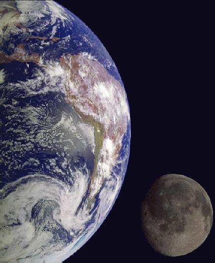 |
| The Galileo spacecraft took these photographs in 1992 on its way to explore the Jupiter system. Separate images of the Earth and Moon were combined to generate this view. The image of the Earth is centered on the Pacific Ocean at about latitude 20 degrees south. The west coast of South America can be seen, as well as the Caribbean; swirling white cloud patterns indicate storms in the southeast Pacific. |
| Click on file name below to download this image: |
| earthmoon.jpg | 442 x 540 pixels, 37 Kb |
| GPN-2000-001437.jpg | 724 x 885 pixels, 380 Kb |
| GPN-2000-001437.jpg | 1696 x 2074 pixels, 1.3 Mb |