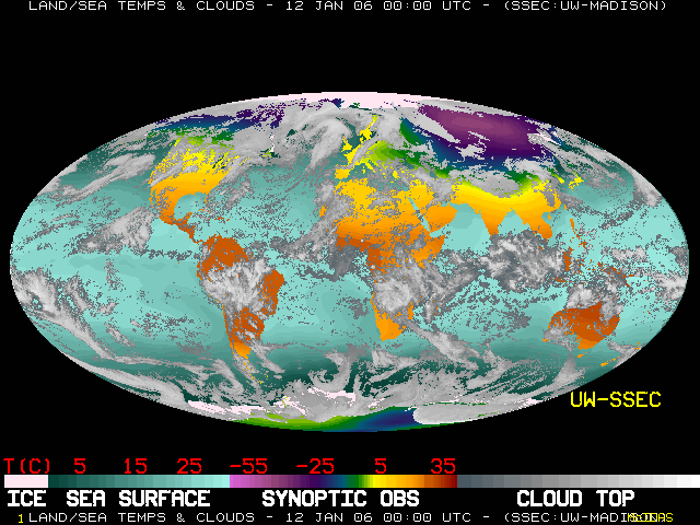
| This picture combines the latest data from all
available weather satellite imagery to produce a view of the entire Earth. To enable continuous night and day viewing of cloud patterns, infrared
satellite imagery is used to detect clouds by their temperature. The coldest clouds are
displayed in bright white color, while the warmest clouds appear dark gray. In general,
the coldest clouds are found at high altitudes while warmer clouds are found closer to the
earth's surface. |